Unanswered questions: Did authorities overlook land feasibility before acquisition? Why was the major portion of land deemed unusable only after acquisition?
MARGAO
A solution seemed in sight to the row over the road access to the acquired land for the burial grounds/ Kabrastan at Sonsodo, thanks to Church authorities.
For, the St Joaquim Chapel Committee (as per the reply to a Legislative Assembly question) has submitted before the High Court that there is alternate access available from the adjacent property which can be used as an access to the land acquired for the burial ground/ Kabrastan.
What about the land admeasuring 30,191 square metres acquired at Sonsodo for the burial grounds? Will the road access in any way change the ground reality of the hilly and sloppy land acquired for the proposed burial grounds/ Kabrastan?
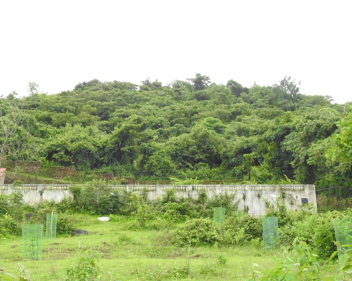
For, while the powers that be and the Margao Municipal Council went to the town tom-tomming of having acquired land admeasuring 30,191 square metres for the burial grounds, realisation has now dawned that only a minuscule portion of the huge land, around 2,500 square metres to be precise, can be utilised for the proposed burial grounds. Part of the balance land can be developed only if the TCP rules and regulations are tweaked.
In fact, the consultant appointed by Goa State Urban Development Agency (GSUDA) Rahul Deshpande has categorically stated that majority of the acquired land in question has a gradient higher than 25 per cent. That’s not all. The consultant, who had conducted a survey of the plot bearing Chalta No. 1 of PT Sheet No. 50 & 49 1(Part), had categorically stated that the land in question is not developable under the present Town and Country Planning rules and regulations.
In fact, the consultant had stated that only the lower part (south side) of the acquired plot is developable after substantial land development and hill cutting. This means that only land admeasuring approximately 2,500 square metres will be available for development of the burial grounds.
This has only brought to the fore the moot question whether the Margao Municipal Council and the powers that be had failed to take the gradient and the nature of the sloppy land in question into account before going in for acquisition of the land at Sonsodo.
For, the Margao Municipal Council was first caught on the wrong foot after realisation dawned that the civic body made no provision for a dedicated access road to the acquired land from the main Curtorim-Margao road. In fact, the MMC acquired the road access, linking the main road to the existing Christian cemetery, indicating that the land acquisition process was set in motion by the civic body without taking into account the ground reality.
Land acquisition for the burial grounds/ Kabrastan
Questions may be raised why the Margao Municipal Council rushed to acquire the land admeasuring 30,191 square metres land at Sonsodo when the survey conducted by the GSUDA-appointed consultant revealed that only 2,500 square metres of the acquired land can be developed under the Town and Country Planning rules and regulations?
Well, this question may come to haunt the Margao Municipality as well as the powers that be since major chunk of the acquired land in question cannot be utilised for the purpose for which it was acquired for by the civic body.
This question assumes further significance and comes against the backdrop of the fact that the MMC had acquired the land in question for all the three religious communities as per Council resolution No. 3808 held at its meeting on June 28, 2010. It’s another matter that the MMC has now claimed that the resolution No. 3808 was modified a year later on June 13, 2011 stating that the land in question will be utilised only to set up a Kabrastan. “Just image a situation if the acquired land in question was to be utilised for burial grounds for all the three religious communities. The developable land admeasuring 2,500 square metres out of the total 30,191 square metres would not have been sufficient to meet the requirements of even one religious community,” remarked an official.
Survey report prepared by Rahul Deshpande & Associates on January 19, 2023
The survey of plot bearing survey number Chalta No. 1 of PT sheet No. 50 & 49 1(part) was conducted using DGPS method/ survey equipment, for a plot admeasuring 30,191 m2 as per the land acquisition records. On study of the survey report the following observations are made:
Report states that the plot is sloping, with a gradient higher than 25 degrees.
- The area of plot surveyed on ground admeasures 30,145 m2
- Majority of the land has a gradient higher than 25% and is not developable under present Town and Country Planning rules and regulations
- The lower part (south side) of the acquired plot guidelines, marked “B” on plan enclosed, is developable after substantial land development and hill cutting. The width of this stretch would be 15.00 m wide, admeasuring approximately 2,500 m2
- Parts of the remaining plot can be developed, if certain rules and regulations of Town and Country Planning are relaxed
- The approach road (A) of the said plot, which is a part of the land acquisition, has been used by the Christian cemetery
- The said acquired plot of 30,191 m2, has no other approach road or access, other than the 10m wide admeasuring 1,043 m2