Central expert’s recommendations to contain flooding in key areas still confined to papers; Authorities claim report forwarded to relevant departments, but no action taken till date
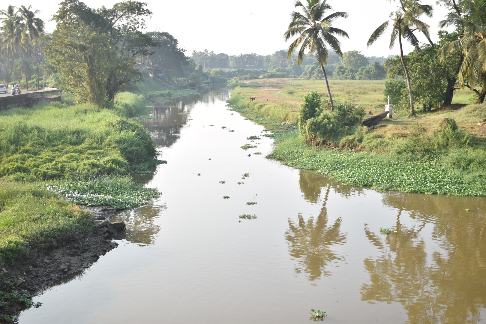
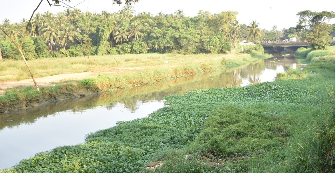
The state of affairs of the River Sal stretch on the Benaulim-Khareband stretch.
MARGAO
The 11-km Margao Western bypass is finally in place, ready for commissioning. Once commissioned, the Rs 482 crore road bypass, from Navelim to Verna, is expected to streamline traffic on the NH66 and ease traffic congestion in the commercial capital and the adjoining villages.
How about the River Sal? Has any comprehensive drainage plan put in place to mitigate flooding along the flood prone areas of Benaulim-Khareband-Mungul-Seraulim belt? Have the authorities increased the number of culverts on the Khareband-Benaulim-Varca road for the smooth flow of water from the water catchment Tolleaband water body into the adjoining River Sal?
These and other questions have come to the fore as the Western bypass is ready for commissioning, but sadly, the recommendations made by the Central expert R K Pandey to contain flooding along the areas prone for flooding still remains confined to the papers.
Union Surface Transport Minister Nitin Gadkari had drafted R K Pandey to study the flood prone areas around the Khareband-Benaulim belt in response to the petition filed by Goa Forward chief Vijai Sardesai demanding the construction of the Western bypass on stilts passing through the water catchment Tolleaband water body in Benaulim.
While the demand for the construction of the bypass on stilts through Tolleaband water body did not find favour with Pandey, the expert, however, had suggested a host of measures, including a comprehensive drainage plan, including increasing the discharge capacity of River Sal through de-silting and dredging.
That’s not all. The expert had further stressed on the need to provide additional discharge areas from Varca road to the adjoining River Sal by increasing the culvert size or its numbers.
Has the ground reality changed for the better since August 2023 since the time Pandey had submitted the report to the PWD, National Highways? Other than the construction of a culvert on the Khareband-Varca road, the recommendations made by Pandey, including a comprehensive drainage plan has gone abegging.
Consider this. When The Goan called up a senior PWD, NH official to shed light on R K Pandey’s report on the comprehensive drainage plan for the Khareband-Benaulim stretch, the official said the report has been forwarded to the PWD, Roads and the Water Resources Department for execution.
A top WRD official, however, has feigned ignorance on Pandey’s report, saying he is unaware of a report submitted by the Central expert. He, however, hastened to add that the WRD will certainly pursue the recommendations if a copy of the R K Pandey report is made available to the department.
Benaulim-based activist and petitioner in the National Green Tribunal, Royla Fernandes pointed out that villagers of Benaulim have been waging a struggle to get the bypass on stilts for the simple reason that building the bypass through the fragile water bodies along the River Sal flood plains would cause destruction. “Our struggle had met with partial success when the government decided to build the bypass on stilts along the 1.2 km stretch from Seraulim to Mungul after the NGT-constituted panel recommended bypass on stilt on the stretch. Since the Central expert R K Pandey had suggested a slew of measures to contain flooding around the Benaulim-Khareband-Seraulim water catchment areas, it is high time the government implement the recommendations in letter and spirit.”
She added: “People of Benaulim had never objected to the Western bypass per se. What they have been demanding is the construction of the bypass road on stilts. Now, since the bypass is complete and ready for commissioning, the government should lose no time to implement the flood control measures suggested by Pandey, who was deputed to conduct a study by none other than Union Minister for Surface and Road Transport Nitin Gadkari.”
Central expert’s report highlighted need for quick drainage solutions
MARGAO: The Central expert R K Pandey had come clear on flooding at the Khareband-Benaulim flood plains of River Sal, pointing out that flooding in the flood prone low-lying area is a routine phenomenon during monsoons and cannot be prevented entirely, till a comprehensive drainage plan addressing the outfall issue is sorted out.
In his report, Pandey was categorical in saying that the discharge capacity of River Sal also needs to be taken into consideration, which appears too low, further suggesting that measures for increasing the discharge capacity of River Sal may be taken including de-silting/ dredging.
That’s not all. Pandey was also categorical in insisting on increasing the number of culverts on the Khareband-Varca road. Taking cognisance of the fact that the bypass passing through the Tolleaband water body has been provided with 10 culverts, the expert had expressed his surprise that the Varca road had only two culverts. “The bypass is having 10 Nos. of balancing culverts in 650 m length (total area 157 sqm), the 750m Varca road is having only 2 Nos. culverts (total area 36 sqm) for discharging water into the River Sal, which is insufficient for quick drainage. There is need to provide additional discharge areas from Varca road to River Sal by way of increasing the culvert size or its numbers,” Pandey had insisted in his report.