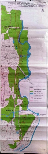
The western bypass alignment between Seraulim and Benaulim.
MARGAO
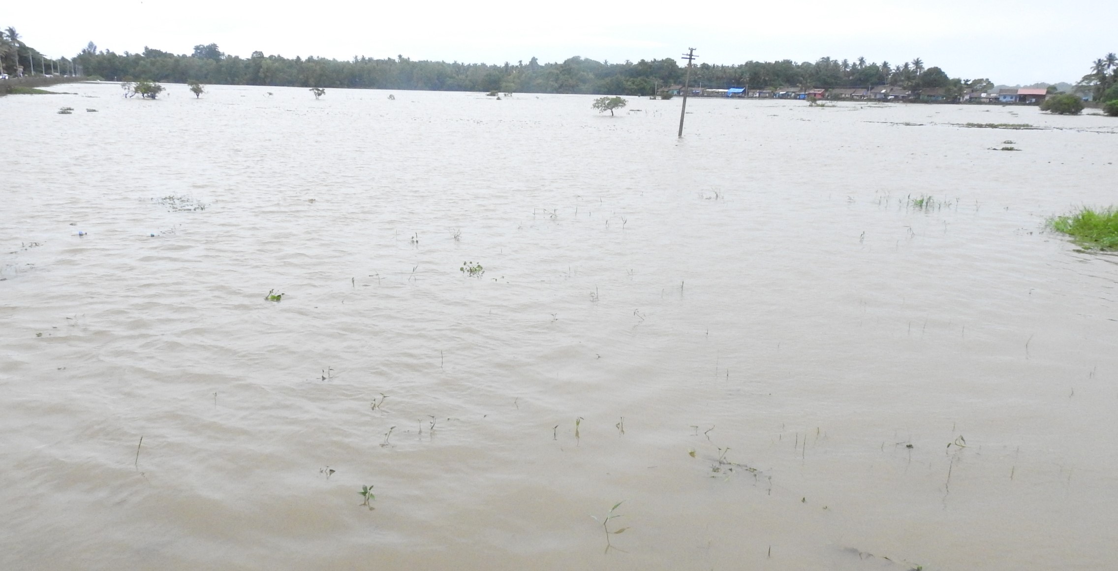
How many more panels and reports would the government require to realize its folly and stop bulldozing its way with the construction of the remaining 2.75 Km part of the controversial stretch of the Western bypass by filling up the wet lands and flood plains of river Sal between Seraulim and Benaulim?
National Green Tribunal’s (NGT) recent order constituting a 10-member joint panel of expert agencies, including the Goa Environment Impact Assessment Authority (GEIAA) to go into the flooding aspects raised by environmentalists has only brought to the fore this question since previous studies and recommendations cautioning the bypass construction through the flood plains sans stilts fell on deaf ears.
‘The Goan’ has access to reports that even before the land acquisition for the 11-km bypass was completed around two decades ago, an expert committee headed by former Sub-divisional Magistrate, Margao Sanjit Rodrigues had recommended to the government to give a second thought to the construction of western bypass through the wetlands.
That the government did not give a second thought is a different matter, the National Highways went ahead with the project, turning a blind eye to the plain truth that the bypass alignment passes through the flood plains of River Sal, which lay submerged and inundated during monsoons.
Take note, additional drainage culverts were incorporated in the 2.75 km bypass between Seraulim and Benaulim after then Chief Minister Manohar Parrikar took cognizance of the sustained battle waged by the local residents and greens at gram sabhas and outside against the construction of the bypass sans stilts.
But, the latest study report and recommendations made by the Water Resources Department (WRD) on the 2.75 km bypass compiled by the Water Resources Department has given a ray of hope to the villagers as well as environmentalists demanding construction of the bypass on stilts.
The report, a copy of which was attached to the petition made to the National Green Tribunal (NGT) by petitioner Royla Fernandes, has only brought to the fore questions that the National Highways was trying to bulldoze with the project without taking a host of aspects relating to ecology and biodiversity into account.
Given that the bypass alignment would require filling up the river at one point, the report has recommended a bridge over River Sal by maintaining the flow area/water way, the reduction in the water way duly compensating the flow area occupied by the piers.
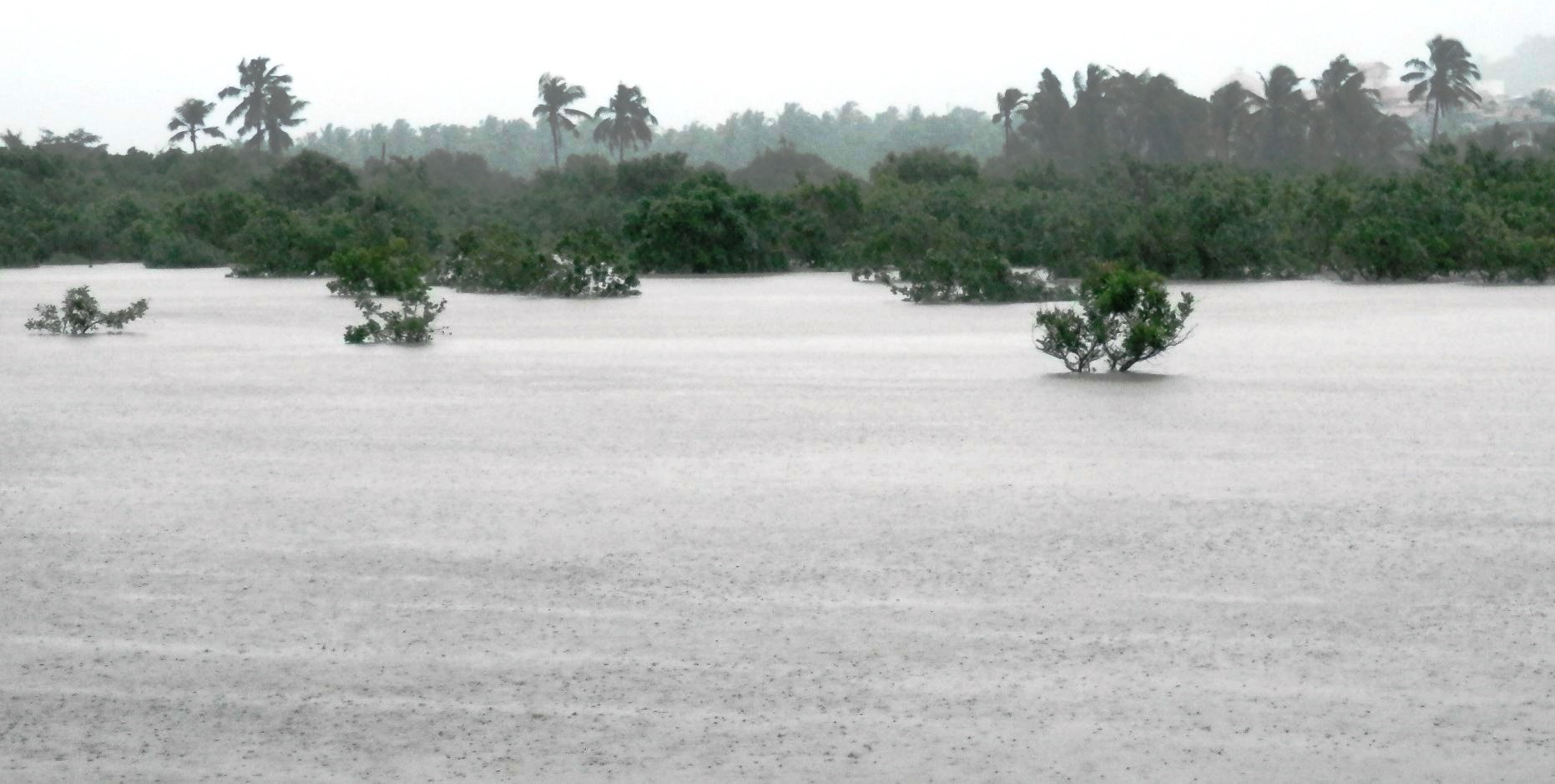
The submerged low lying fields in Mungul as a result of the recent downpour.
Apart from recommending a bridge over the river, the report has recommended that the water body on the Colva Road (W) to be maintained.
The report which has been forwarded to the Principal Chief Engineer and the Chief Engineer, National Highway Authority of India, Goa region on June 2 has recommended around 14 openings along the NH stretch, besides a proper bridge over the river stretch by maintaining the flow/water way to minimize fragmentation of the ecosystem in addition to ensuring the integrity of the flood plain zones.
Says petitioner in the NGT Royla Fernandes: “The WRD report has nailed the Highway on many aspects, but the report did not recommend construction of the bypass on stilts. Just imagine a situation if the WRD had not to conduct the study and compile the report and the National Highway would have gone about destroying the river and the water bodies”.
 The Tolleabandh Lake at Benaulim which gets inundated during the rainy season.
MARGAO: Even before the land acquisition for the proposed western bypass was completed, a high-level committee headed by then Margao Sub-divisional Magistrate Sanjit Rodrigues had around two decades ago recommended that the government give a second thought to the construction of the western bypass passing through the flood plains.
In fact, the Action Plan to avoid flooding in flood prone areas of Salcete prepared by the committee headed by Sanjit Rodrigues, who has recently returned to Margao in the South Collectorate as Additional Collector, has even recommended four-laning of the Eastern bypass road instead of going ahead with the Nuvem-Navelim bypass.
The report states“In the vast low lying areas from Ambaji, Seraulim, Pedda areas serve as a vast efflux for storm water as 'well as silting basin. Major developments in these areas should be considered with abundant caution. A point in case is the ongoing controversy regarding the vast filing which has been carried out at Pedda, Benaulim. Another development is the proposed Western Bypass road from Nuvem to Navelim which will cut a road across this drainage path and should involve a massive provision of crossdrainage including causeway section if it should not pose a major problem. A second thought is recommended regarding this project and instead the required Bypass to Margao could be achieved, if required by four-laning the Eastern Bypass road part of which is constructed”