MAPUSA
The State welcomed the southwest monsoon with uncharacteristic haste this year, as dark clouds rolled in as early as May 25, almost 12 days ahead of the usual schedule.
The early arrival raised hopes of a robust rainy season – but those hopes have largely withered as June drew to a close with a rainfall deficit of 11 percent.
According to data from the India Meteorological Department (IMD), the State recorded 774.9 mm of rainfall between June 1 and June 29, falling short of the normal average of 871.8 mm.
What’s more concerning is not just the quantity but the erratic nature of the rainfall – short-lived downpours followed by prolonged dry spells – rendering the opening month of the monsoon season underwhelming.
Patchwork rains
While the initial showers painted a promising picture, the monsoon soon lost its steam. Scanty rainfall became the norm, with some stations recording less than 10 mm of rain on multiple days.
To illustrate: only 1.3 mm was logged on June 5, 1.2 mm on June 7 and 6.4 mm on June 9. In fact, no rainfall at all was reported on June 6 and a mere 0.2 mm on June 10.
The heaviest single-day downpour came on June 12, when the State received 100.8 mm of rain – a rare peak in an otherwise tepid pattern.
Among the monitoring stations, Dharbandora in South Goa emerged as the wettest location with 1087.2 mm, the only one to cross the 1000 mm threshold. In sharp contrast, Mormugao recorded just 492.5 mm – the lowest total in the State for the month.
Meteorological
mismatch
Experts believe the weak monsoon performance can be pinned down to missing atmospheric players. According to Dr M R Ramesh Kumar, a former scientist at the National Institute of Oceanography (NIO), the monsoon’s early arrival was misleading.
“The early onset flattered to deceive. Though it began with vigour, the critical supporting systems like the low-level jet and cross-equatorial flow were absent. These are essential to sustain and distribute rainfall effectively and their lack left a vacuum in June,” he explained.
However, Dr Kumar remains cautiously optimistic. He anticipates a turnaround in July and August, driven by strengthening cross-equatorial winds and the possible formation of low-pressure systems over the Bay of Bengal.
“We expect improved monsoon conditions as more convective activity builds up. The monsoon should gain strength in the coming weeks,” he added.
Yellow alert &
renewed hope
Signs of revival are already on the horizon. The IMD has issued a yellow alert for Goa, forecasting light to moderate rain with isolated heavy spells through July 5.
The alert comes with a note of caution, especially for low-lying and flood-prone areas, which may be vulnerable if rainfall intensifies unexpectedly.
An IMD official noted that the current phase is still transitional.
“Though June ended on a weaker note, the monsoon is far from over. The system is evolving and we are tracking several indicators that point to an uptick in activity. July is expected to be more active,” the official said.
Waiting game
for farmers
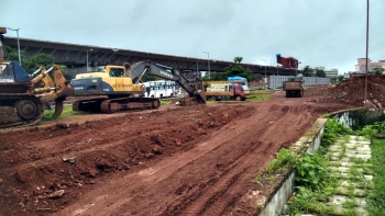
The weak start has had a ripple effect on Goa’s farming sector. In interior and rain-fed regions, timely sowing is crucial – and this year's erratic June rains have left farmers uncertain.
According to officials from the Directorate of Agriculture, sowing has been delayed in some interior areas, although there is still a window to recover, provided July delivers.
Looking ahead
With the arrival of July, hopes for a stronger monsoon are pinned on changing atmospheric dynamics and a possible surge in rainfall activity.
While June may have disappointed, the larger monsoon story for Goa is still unfolding.