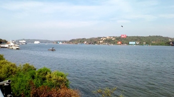
The Mandovi and Zuari are major rivers of Goa. The mouth of the Mandovi, which has a width of 4 km and narrows to 100 mts at a distance of around 40 km to the east, is where seawater enters. The depth varies from 7 mts at the mouth to 1 mts at the head. The river is about 750 mts wide and 5 mts deep near Patto Ribandar. Farther upstream, the river splits into two channels near the Divar Island and merges again at the upstream end of Divar, into a massive network of little canals in a swampy environment.
Throughout the 50-km route, several rivers converge to form the Mandovi at the upstream end. It is joined by the Mhadei, Ragda, and Khandepar rivers in the vicinity of Ganjem and Kulem, respectively. At Ganjem and Kulem, respectively, the average annual runoff is 3400 (±648) million cubic meters and 502 (±91) million cubic meters. The Valvat, Dicholi, and Kudnem rivers contribute 25%; the Mapusa, Moira, and Assonora rivers contribute 14%; and the remaining 16% comes from several minor rivulets. According to a hydrological model analysis, runoff in the Mandovi doubles from head to mouth as a result of contributions from the tributaries (PhD thesis of Suprit 2010, Goa Univ.). During June-September, these rivers, particularly Mhadei, gets significant amount of freshwater (runoff) from a catchment area of around 1,895 sq kms in the thick forests in Karnataka.
How do freshwater runoffs vary in Mandovi?
When monsoon runoff from all rivers is taken into account, the estuary becomes flooded with freshwater. According to the study carried out by Vijith et al. (2009 (published in Estuarine, Coastal and Shelf Science), taking the estimate of runoff at the mouth roughly as two times that at the head, the total seasonal runoff into the estuary is approximately 40 times the volume of the estuary (160 million cubic meters). With this much runoff, it is expected that the estuary gets flushed many times over during the monsoon. Runoff data collected during 1979“1999 show that the monthly average runoff at the head of the river from January to May is correspondingly 10.4, 4.4, 2.1, 1.0 and 1.3, all in million cubic meters.
How salinity varies in estuary?
Salinity (amount of salt in one litter of water) in the Mandovi is time-dependent and exhibits an annual cycle. During June-Sept. huge runoff dilutes the salt, while during November-May, the seawater ingresses upstream into the River when runoff decreases. According to the hydrographic data collected in 2007 by Vijith et al. (2009) high salinity (35.5 practical salinity unit-psu) is observed at a distance of 6 km from the mouth (at Patto-Ribandar) in May. With an increase in freshwater during June-July, the salinity begin to decrease, so much so that the estuary behaves like a fresh water river, at least during heavy rainfall, except for the region 10 km from the mouth. By the end of August, there is a monotonic increase in salinity due to seawater ingression into the Mandovi with 30 psu salinity contour at 7 km, 9 km (mid-October), 10 km by mid-January. By mid-May, 15-psu salinity contour extends 33 km toward the head of the River.
What is the role of runoff on Mandovi river circulation?
The hydrodynamic model case study of Vijith et al. (2016) (published in Estuarine, Coastal and Shelf Science), demonstrated how the runoffs changes the salinity in the River for the environmental conditions of 2007. In June when the runoff is large (1,706 cubic meters per second- cmps), the entire estuary experiences a seaward velocity greater than 1m/s. At the upstream end the circulation consists of surface velocity at 1.5 m/s directed seaward. During this time the estuary is flushed with freshwater. When the runoff is about 195 cmps, salt water intrudes into the estuary at deeper depth with a velocity of 0.1 m/s, while the surface seaward velocity is about 0.40 m/s, which is restricted to a region of up to 10 km from the mouth into the river. The intrusion causes a salt-wedge at the mouth. After the monsoon ceases, the runoff is in the range of 10-100 cmps and the surface and bottom residual velocities are same, about 5 cm/s. By late October, the seawater extends 15-km into the river. By December 25 it extends to 25 km from the mouth.
During the dry season, when the runoff decreases to 1 cmps, the saline water monotonically intrudes into the river on March 1, 2008. To the end of February 2008, when the runoff is 13 cmps, the saltwater marked by 5 psu is located at 29 km from the mouth, and on 16 April 2008 it is detected at 34 km into the interior from the mouth. The results also indicate that irrespective of magnitude of runoff, neap/spring tidal currents has important role in the river circulation.
The above circulation shows that an efficient ventilation system is provided by the seawater flow at the bottom, which draws in fresh marine water and exhausts river water which during rainy season. The runoff carries a high load of terrigenous organic matter, nutrients (phosphate, nitrate, nitrite, silicate) and other pollutants (including plastics). Without this natural flushing process, the river would stagnate, and oxygen levels would decrease.
The circulation system promotes mixing at the interface of seawater and freshwater marked by high organic matter and nutrients which makes the river incredibly productive in terms of growth of microscopic plants (phytoplankton) which is the food for fish. Abundant plankton serves as the foundation for a variety of valuable food webs, which in turn supports fresh water fish. Now you wonder why we get tones of tasty fish all year round from our rivers.