


THE GOAN NETWORK
VASCO
The Mormugao Municipal Council (MMC) has launched its Geographical Information Survey (GIS) Mapping project, making it the first council in South Goa to initiate such an ambitious endeavour after a 28-year gap.
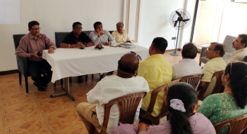
On Friday, MMC Chairperson Girish Borker chaired a meeting with GSUDA representatives, MMC councillors, and Chief Officer Deepesh Priolkar to discuss the project.
Later speaking to media persons, Savio D’Souza from GSUDA highlighted the importance of the initiative.
"This is important for proper property tax assessment. Most structures have not been accounted for, causing revenue leakage. Conducting a GIS-based survey of all structures, both authorised and unauthorised, will make everything transparent and visible on a unified Goa map,” said D’Souza.
“The project will enhance transparency and accountability, allowing the public to view all mapped data. The MMC will gain better control over tax management and can track any encroachments by integrating construction licenses into the system. This mapping does not change the legal standing of structures; it aims to collect charges for services rendered by the MMC.”
D’Souza pointed out that some residents have expanded their houses without updating their tax information.
"Through this system, all expanded areas will be captured and taxed accordingly. The project, funded by the 15th Finance Commission grants through GSUDA, is a one-time investment for MMC and can be recovered in two years. We expect the entire South Goa GIS Mapping to be completed in 18 months," said D’Souza.
MMC Chairperson Girish Borker expressed optimism about the initiative’s impact on MMC’s revenue.
"The best part of the initiative is that properties of central organisations like the Navy and Railways will also be mapped. Previously, they did not pay us anything, but now we have the chance to collect taxes from them. The last survey was done 28 years ago.”
MMC Chief Officer Deepesh Priolkar underscored the necessity of the GIS Mapping for MMC's financial stability.
"We had started manual assessments, but work done by an expert agency is more accurate. The work began in North Goa, and I requested the DMA and GSUDA to start in MMC due to our dire financial situation,” said Priolkar.
“Accurate data from this initiative will double our house tax revenue and help us become self-sufficient. We aim to implement this system by April 2025. I seek the cooperation from the public, government organisations, MLAs, and councillors. The GIS Mapping project promises to modernise property tax assessment, enhance revenue generation, and provide MMC with the financial stability needed for future developments,” Priolkar added.


