But while the interior and coastal belts recorded intense rainfall, the capital city, Panaji, remained comparatively low on the intensity scale.
Rainfall data showed that the State recorded 87.4 mm rainfall in the 24 hours ending 8.30 am on Tuesday, marking a season-high single-day accumulation.
The sharpest impacts were seen at five stations where rainfall exceeded 10cm. Canacona emerged as the wettest station at 19.2 cm, followed by Mapusa at 13.1 cm, Quepem at 13 cm, Sanguem at 12 cm and Margao at 11.2 cm.
On the seasonal front, Canacona continues to lead with 660 mm rainfall, followed by Margao at 349 mm, Pernem at 279 mm, Old Goa at 277 mm and Mormugao at 276 mm.
At the lower end, Ponda has recorded 137 mm and Panaji 157 mm so far this monsoon, indicating a relatively subdued seasonal total in the capital compared to southern and coastal belts.
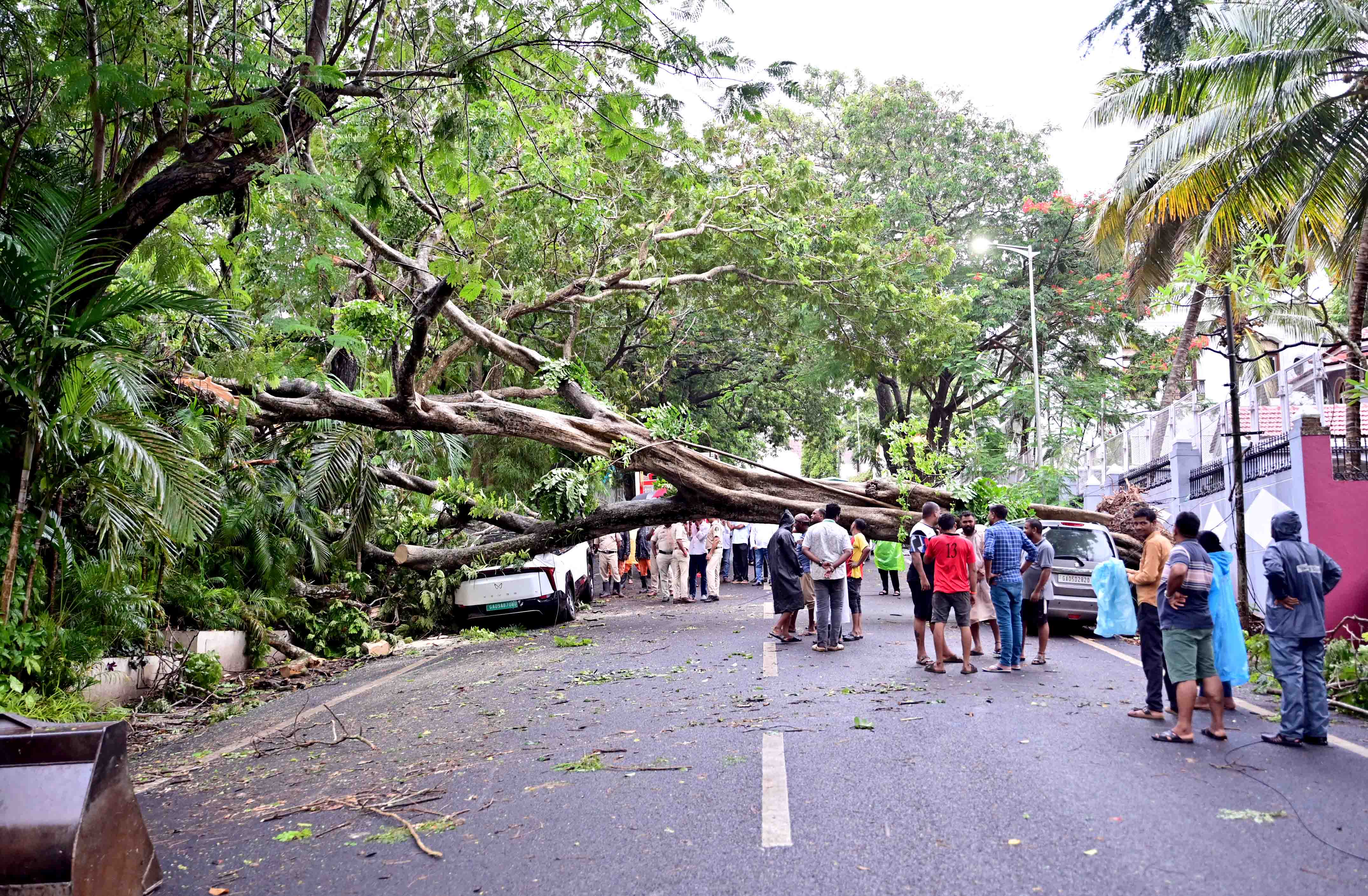
The India Meteorological Department (IMD) Goa, has issued an Orange Alert for June 25, warning of heavy to very heavy rainfall at isolated places across North and South Goa. Yellow alerts are in place for June 24 and June 26 to 29.
Weather experts attribute the current spell to an active low-level jet stream driving moisture-laden winds from the peninsular region into Goa, sustaining widespread rainfall activity.
“The monsoon over Goa is in active phase, which is due to the strong low-level jet stream, which is at a height of about 1500 m above mean Sea level, and the core of the Jet Stream is located around 15 N. Further, the upper-level winds have been southwesterlies from 500 m to 1500 m over the state of Goa with wind speeds of 25 to 35 knots. This has resulted in bringing copious amounts of moisture into peninsular India, including our own state of Goa,” Meteorologist and former National Institute of Oceanography chief scientist M R Ramesh Kumar said, speaking to The Goan.
Meteorological observations indicate that day temperatures have eased to around 29-30°C, with minimum temperatures settling between 24-25°C, which will continue till June 29.