


the goan I network
VALPOI
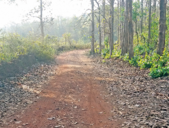
Responding to several demands, authorities have decided to develop a 2.8 km road at Pal-Sattari, which will cut short the distance between Valpoi and Belgaum by 30 kms.
At present, people from different parts of Valpoi and surrounding areas have to proceed through a 110-km Valpoi-Belgaum route via Honda, Morlem, Keri and Chorla.
But with the road developed at Pal, the route will be cut down by 30 kms and the 80-km Valpoi-Belgaum route will pass through Koparde, Pal, Jambhul Junction and Chorla, thereby benefiting motorists and commuters from Valpoi, Thane, Nagargao and even as far as Usgao in Ponda taluka.
According to sources, PWD authorities have issued the work order to start construction work along the 2.8 km route at Pal village, which will provide connectivity to the Keri-Chorla road at Jambhul junction.
According to locals, the mud road at Pal had existed since the Portuguese rule and people from the area would use the route to travel to Chorla, Kankumbi, Keri and Belgaum.
The road had deteriorated over the years, making it difficult for motorists to travel along the route. Former Thane-Dongurle sarpanch late Sitaram Wadkar had repaired the road, but subsequent neglect over the years made it almost unmotorable.
Given the shorter access to Belgaum, people in the area began repeatedly demanding the repair of the road at Pal village and the government initiated efforts to take up the project.
In 2016, the proposal received administrative sanction for Rs 2.8 crore by the PWD department, but was awaiting expenditure sanction.
A few days ago, people from the area met Health Minister Vishwajit Rane, who took up the initiative to follow up on the road project. Authorities then issued the work order to a contractor and work will be commissioned shortly, sources told The Goan.
“This was a long-pending demand of the people. Valpoi town along with surrounding villages will be connected with this road and there will be a good opportunity to develop the region,” said ZP member Fati Gaonkar.


